Updated: October 13, 2026
Palatine offers two kinds of outdoor access: Deer Grove Forest Preserve near town and the Palatine Trail, a local network that combines paved paths with designated streets. The best fit depends on where a home sits and how you plan to use the trails. Check the route to an official entrance, including crossings and street sections, before deciding how convenient the access will be.
Key Takeaways
- Deer Grove Forest Preserve is near Palatine, with access points on Quentin Road north of Dundee Road and on Dundee Road west of Hicks Road.
- The Forest Preserves of Cook County lists 15.5 miles of paved and unpaved Deer Grove trails.
- The Palatine Trail combines paved paths with designated side streets and connects to local parks, schools, Harper College, Palatine Hills Golf Course and other suburban trails.
- Trail access varies by address. Check the full route to an entrance, including street segments and road crossings.
- For current access details, use the official trail maps and check for posted closures or alerts before visiting.
Why do outdoor-focused buyers consider Palatine?
Palatine offers access to a large forest preserve as well as a local trail network. That gives residents options for a nature walk, a paved recreational route or a bike ride that includes neighborhood streets.
The experience is different from one part of town to another. When comparing homes, think about where you would start a walk or ride, how often you expect to use a trail, and whether the route feels comfortable for your needs.
What can you do at Deer Grove Forest Preserve?
Deer Grove is a Forest Preserves of Cook County site near Palatine. The district describes the preserve as nearly 2,000 acres, with woodland, wetlands, ravines and prairie. Its Deer Grove trails include paved and unpaved surfaces, with an estimated total length of 15.5 miles.
Activities listed by the Forest Preserves include walking, bicycling, cross-country skiing and horseback riding. Dogs are allowed on leash. Trail hours are sunrise to sunset, year-round, though conditions and closures can affect access.
The preserve has multiple sections and entrances. For example, the Forest Preserves lists an entrance on North Quentin Road, north of West Dundee Road, and another on West Dundee Road, west of North Hicks Road. Those are near Palatine, but the best access point depends on where you are coming from.
Before heading out, check the Forest Preserves of Cook County’s Deer Grove page and trail maps for access information, trail surfaces and alerts.
What is the Palatine Trail?
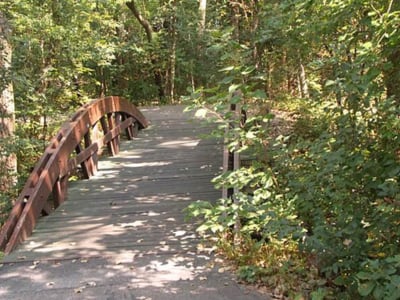
The Palatine Trail is a recreational route through the Palatine Park District community. It combines paved trail sections with designated side streets, so a trip may include both off-road paths and portions alongside local traffic.
The Park District says the trail provides access to schools, Harper College, neighborhood parks, Palatine Hills Golf Course and other northwest suburban bike trails. Its mileage guide lists a 4.7-mile east-to-west route from Anderson Drive to Quentin and Dundee Roads, and a 6.7-mile north-to-south route from Ashwood Park to College Hill Circle.
Those listed routes include connections and segments, not one uninterrupted path. Review the Palatine Park District trail map and mileage information to see which sections match your plans.
How should you check trail access when buying a home in Palatine?
Look beyond the distance shown on a map. The practical route to a trail entrance can depend on sidewalks, street segments, crossings and the location of a formal access point.
Check the route to an official entrance
Map the walking or biking route from the property to the entrance you expect to use. Straight-line distance does not show whether a fence, road or lack of a connecting path changes the trip.
Notice streets and crossings
Some Palatine Trail sections use designated streets. Look at the specific crossings and traffic conditions along your route. If possible, walk or ride it at the time of day you expect to go.
Match the trail to your plans
A paved neighborhood route may suit a daily walk or casual bike ride. Someone looking for unpaved surfaces, longer outings or a more natural setting may prefer Deer Grove. Think about the activity you will do most often.
Consider surfaces and seasonal conditions
Deer Grove includes paved and unpaved trails, and local routes may include both trail and street sections. Rain, snow and seasonal vegetation can affect the experience. Check current information and use footwear or equipment suited to the route.
For help comparing different areas of town, see the guide to choosing a Palatine neighborhood and the broader Palatine neighborhood guide.
How does outdoor access fit into a home search?
Trail access can be one part of the decision, alongside commute options, home style, property taxes, school boundaries and proximity to downtown. A home near a trail may appeal to you, but it still needs to fit your day-to-day priorities.
If you are comparing nearby communities, you can also read about parks and outdoor recreation in Arlington Heights or explore what it is like to live in Palatine.
Frequently Asked Questions About Palatine Trails
How long is the Palatine Trail?
The Palatine Park District’s mileage guide lists an east-to-west route of 4.7 miles and a north-to-south route of 6.7 miles from Ashwood Park to College Hill Circle. The trail combines paved sections with designated side streets, so check the Park District map for the route and segments you plan to use.
How many miles of trails are at Deer Grove?
The Forest Preserves of Cook County lists an estimated 15.5 miles of trails at Deer Grove, with both paved and unpaved surfaces. The preserve also has multiple access points. Check its maps and current alerts before visiting.
Can I bike to Deer Grove Forest Preserve from a Palatine home?
That depends on the address and route. The Forest Preserves lists Deer Grove entrances near Palatine, including one on Quentin Road north of Dundee Road and one on Dundee Road west of Hicks Road. Map the whole route and check street sections and crossings before relying on bike access.
Are Deer Grove trails paved?
Deer Grove has both paved and unpaved trails. Surface and terrain vary by route, so review the Forest Preserves’ trail descriptions and map to choose an option that fits your plans.
Does living near a trail increase a home’s value?
Trail access may matter to some buyers, but it does not determine a home’s value by itself. Condition, size, location, lot characteristics, comparable sales and current market demand all contribute. The impact of nearby trail access can vary by property and neighborhood.
Looking for a home that fits your routines?
If outdoor access is part of your search, we can look at the route from a home to the trails you expect to use and weigh it alongside your other priorities. Schedule a conversation when you are ready.